
Nathan
Copeland
Geospatial developer focused on inspiring others to explore the outdoors and conserve our favorite places. Specializing in geospatial data collection and manipulation along with project planning and quality assessment.Outside of geospatial work, I co-founded an American Ninja Warrior style gym for youth in my local community and enjoy spending time with my kids finding new adventures.
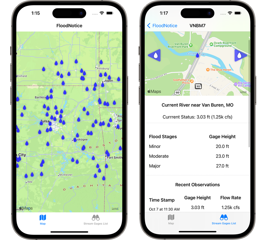
FloodNotice v1-2-1
Initial iOS production release of FloodNotice. Filter streamgages by state and waterbody. View current streamflows compared to flood stage levels. Set favorite streamgages for quick access.
Boating Access
Inspection App
Power Apps-based low code app for reporting boating access site inspections to a SharePoint site.
FloodNotice
(Open-source Version)
SwiftUI-based iOS app to view streamflow data published by the National Weather Service's Advanced Hydrologic Prediction Service.
Lunch Money Dashboard
Simple dashboard to monitor account balances and transactions for a MySchoolBucks account.
Enhancing Gaia GPS's Coverage in Australasia
Adding official topographical maps for Australia and New Zealand to the Gaia GPS map catalog.
Gaia Fishing Map
Experimental fishing focused map layer for Gaia GPS that included a follow-up user feedback survey on the final deliverable.
Gaia GPS USGS Topo Update
Setting up an in-house seamless tileset of United States Geological Survey (USGS) Quad maps and add new historical renditions.
USGS Streamflows
Current streamflow observations which include stream gage locations and comparisons to historical streamflows.
Gaia GPS USFS Update
Build in-house seamless tilesets for the three main Gaia GPS map layers published by the United States Forest Service (USFS).
Snowmobile Trails
Compilation map layer highlighting snowmobile trails and POIs on public and private lands for use within Gaia GPS.
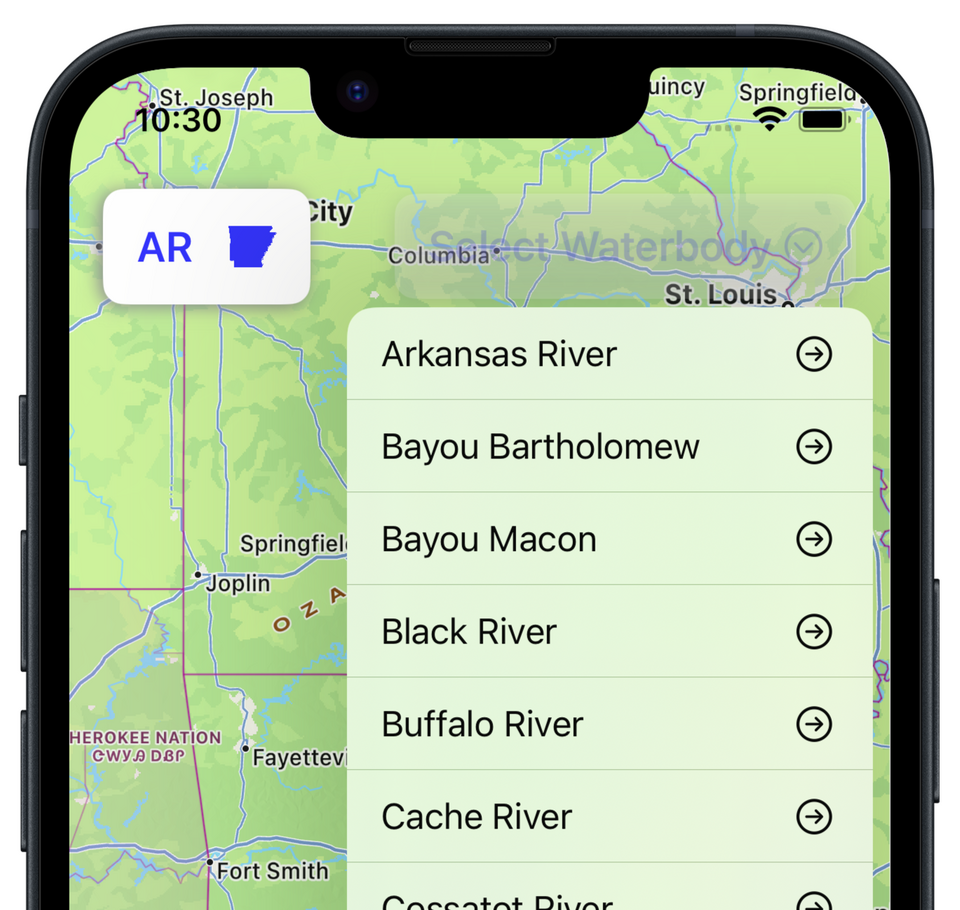
FloodNotice v1-2-1
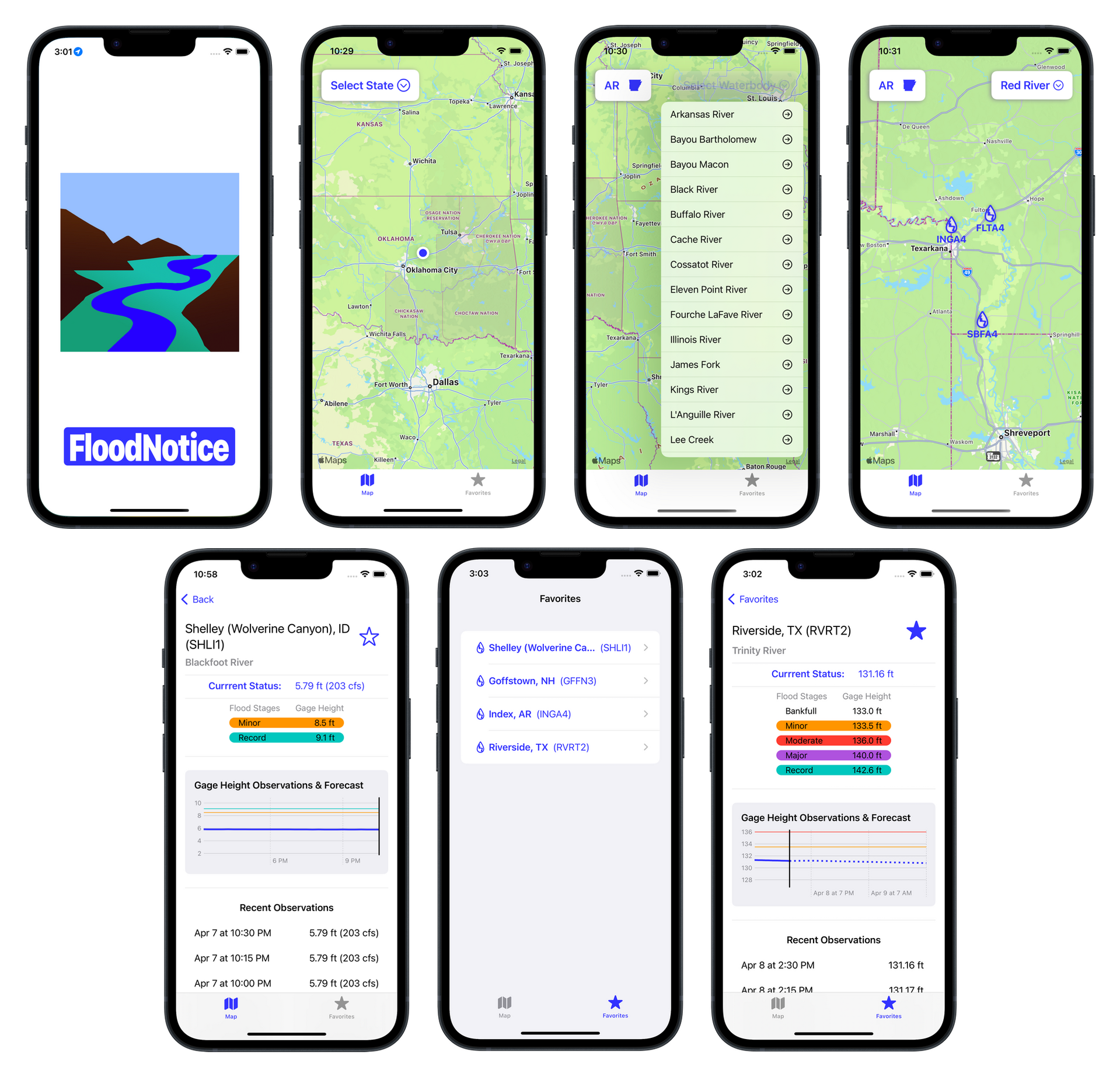
Download FloodNoticeObjectivesBuild a production-quality version of FloodNotice (Open-source version) for interacting with the stream flow data published by the National Weather Service (NWS) Advanced Hydrologic Prediction Service (AHPS).Highlights
Interactive menus to view streamgages by waterbody and state
View your current location on the map
Favorite a streamgage for quick access to current stream flows observations & forecasts
Compare current stream flows to known flood stage levels
Coverage includes all 50 U.S. States and Puerto Rico
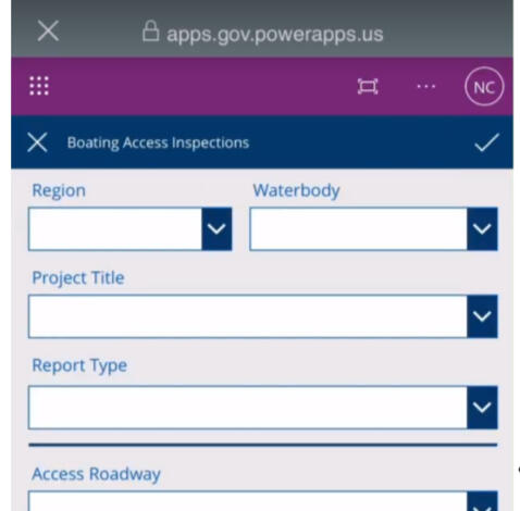
Boating Access
Inspection App
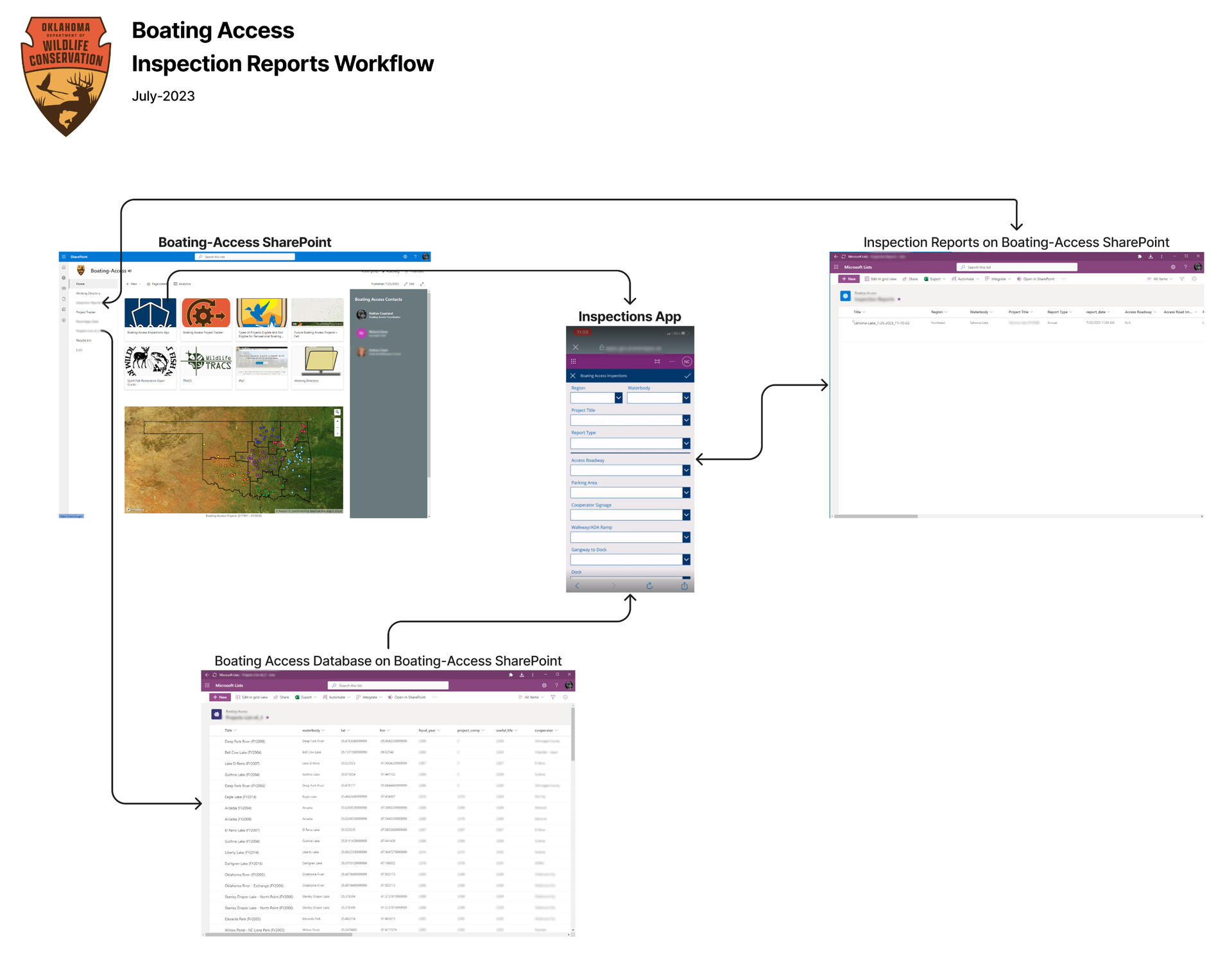
Objective
Develop a cloud-based system to collect and archive boating access site inspections.Background
The Boat Access Sub-program of the Sport Fish Restoration Grant program provides federal funding to develop or renovate public facilities for recreational boating. Funded projects require annual inspections and must be maintained for their useful life duration.Previously, the annual inspections were recorded on paper and emailed, faxed, or mailed to the Boating Access Coordinator for review and archiving causing missing reports and some findings never being shared with cooperators.Results
Utilizing Microsoft's Power App platform, a low-code mobile application was developed to interact with Microsoft Lists hosted on a SharePoint site. The application enabled field staff to submit and review annual inspection reports in the field or at the office. Leveraging the features in Lists, email notifications are sent when new reports are received or past reports are modified. Report photos are hosted on the SharePoint site and hyperlinked within the reports.The cloud-based solution was well received by field staff who appreciated the switch to a paperless system and the streamlined reporting process. Incomplete reports were easy to identify and fix with the increased transparency in reporting.
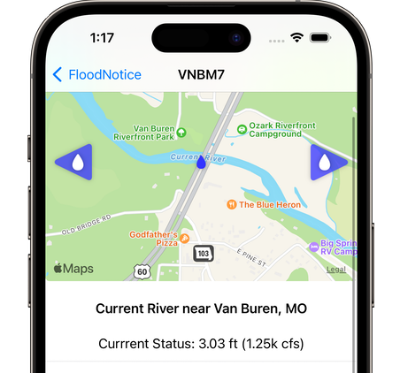
FloodNotice
(Open-source Version)
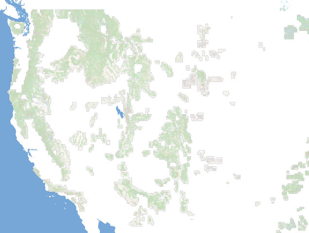
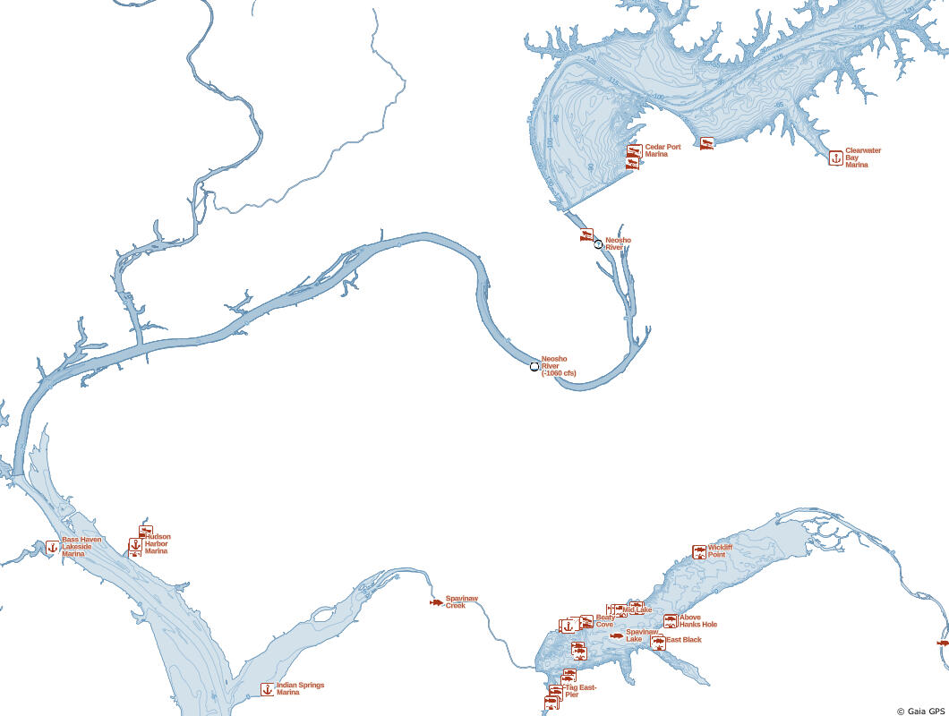
Coverage AreaOzark Mountains
• Future updates will expand the coverage to include the entire US and Puerto Rico.Objectives1. Build a clean, easy to digest rendering of the stream flow data published by the National Weather Service (NWS) Advanced Hydrologic Prediction Service (AHPS).
2. Expand my comprehension of SwiftUI and UX/UI design.BackgroundThe original planning focused on addressing a need within my extended family for a simple, easy to navigate method for interacting with the NWS AHPS that could be utilized by everyone.After chatting with some friends about a Swift app they were tinkering with to teach their kids math, I decided to dust off my comprehension of Swift and challenged myself to build a 100% Swift based app to address this need. Midway through, I decided to make it an open-source project.Several different databases and services were sourced to collect stream gage locations, stream flows, flood stage thresholds, along with geospatial relations amount the stream gages.The location of stream gage stations, current observations, and the forecast are sourced from the NWS AHPS. A crosswalk JSON from NWS is used to build relations between the NWS site identities and United States Geological Survey (USGS) gage identities. Which was required to query the Hydro Network-Linked Data Index (NLDI) to source neighboring stream gage stations.
Gaia Fishing
Coverage Area
Oklahoma and MontanaObjective
Develop an experimental map layer for fishing and conduct a user feedback survey for future enhancements. The initial release included coverage for Montana and Oklahoma while user feedback survey was sent to all Gaia GPS iOS users with an active nautical focused map layer in their account.Multiple datasets were used to build a database of fishing access points, license dealers, fish habitat areas, and bathymetry lines.The project was co-lead and styled by Lee France.
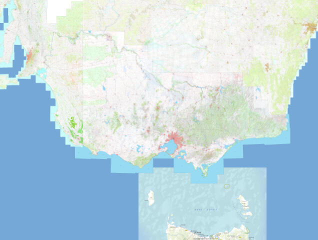
Enhancing Gaia GPS's Coverage in Australasia
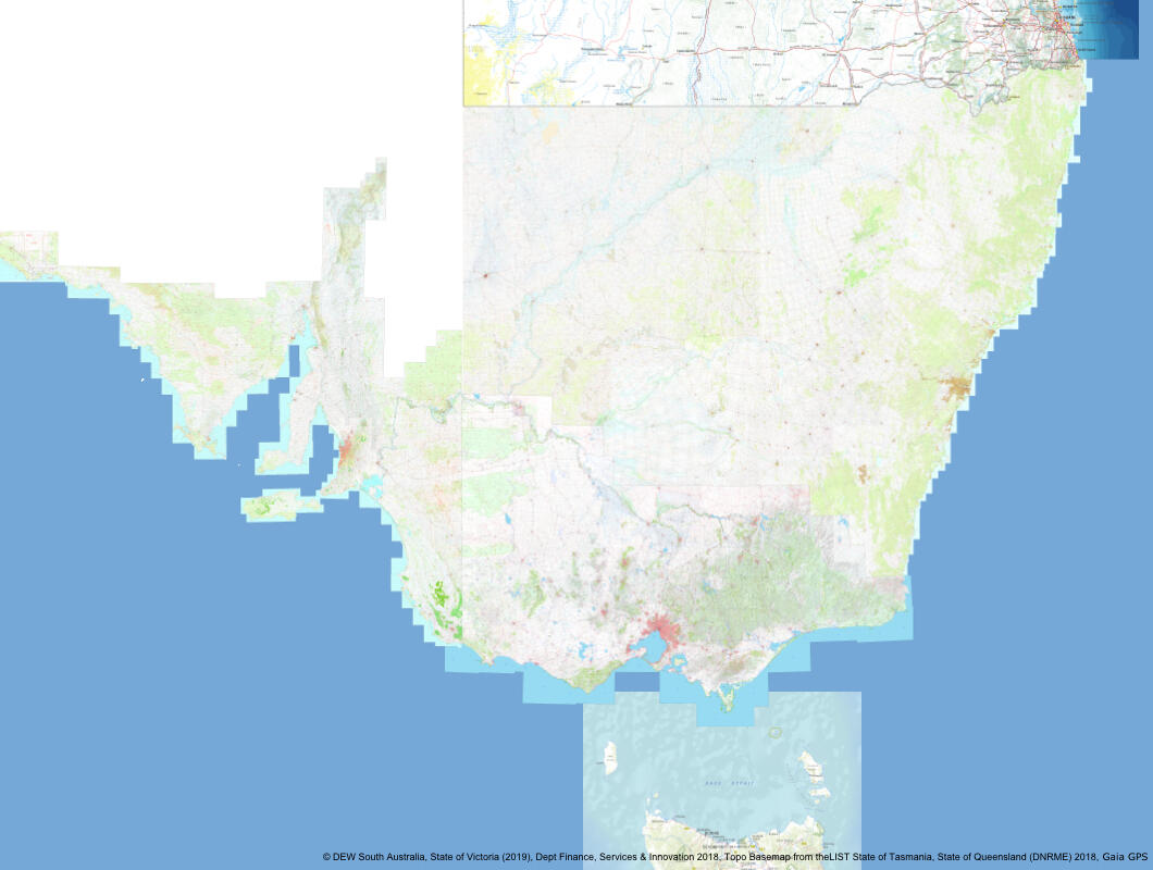
Coverage Areas
• New South Wales
• New Zealand
• Queensland
- South Australia
• Tasmania
• VictoriaObjective
Build out the Gaia GPS map catalog to include official topographical maps published by federal, state, and territory agencies in Australia and New Zealand to meet the raise in users based in Australasia.Background
This project required multiple components to succeed:
1. Obtain rights to publish the proprietary maps within Gaia GPS
2. Develop workflows for processing raw GeoTiffs into borderless COGs
3. Build seamless stacked tilesets using the original map scales to control the min/max zoom levelsThe publishers for Queensland, New South Wales, and Tasmania provided tileset APIs which allowed a quick turn around on implementing these titles into Gaia GPS.Coverage for Victoria, South Australia, and New Zealand was only available as quadrangle GeoTiffs and required additional processing time to build seamless tilesets for each source before adding to Gaia GPS's map catalog.Quadrangle Map Scales by Tileset:
• Victoria (1:100k, 1:50k, & 1:25k)
• New Zealand (1:250k, 1:50k, & 1:25k)
• South Australia (1:250k, 1:100k, 1:50k, & 1:25k)Additional workflows were established to handle updating subsections of the tilesets as new versions of the quadrangle GeoTiffs were released.
Snowmobile Trails
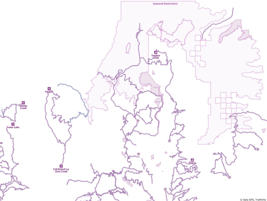
Coverage Area
Colorado, Idaho, Indiana, Iowa, Maine, Michigan, Minnesota, Montana, New York, North Dakota, Pennsylvania, Utah, Washington, and USFS lands along with selected trails in Canada, Europe, and AustraliaObjective
Build a single geospatial database of snowmobile trails and POIs (parking lots, trailheads, warming huts, etc.) published by U.S. federal/state/county agencies, snowmobile clubs within the US and integrate snowmobile trails mapped by Trailforks users.Styled by Lee France
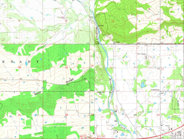
Gaia GPS USGS Topo Update
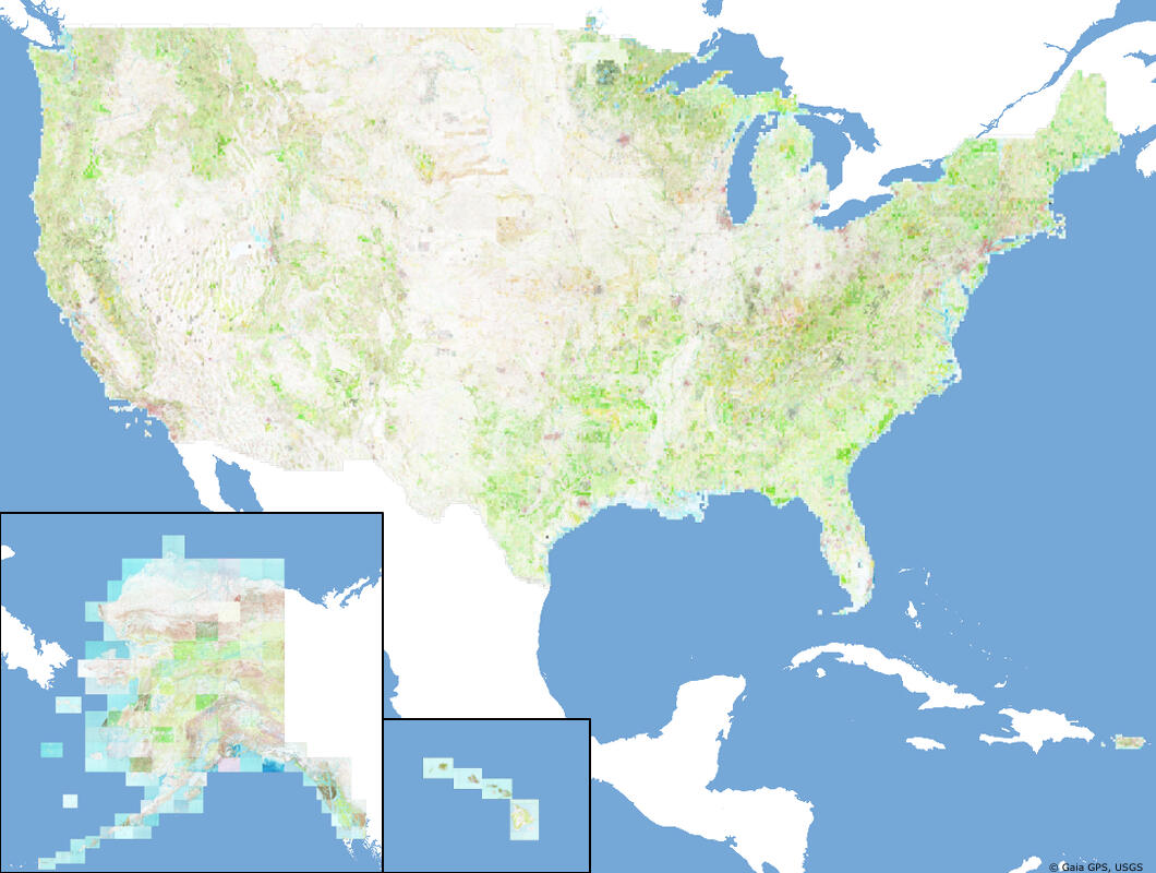
Coverage Areas
United States and Puerto RicoObjectives
1. Develop an in-house index database of United States Geological Survey (USGS) Quads that ranked each quad version by publish date.
2. Build new seamless tilesets for the most recent published quads along with historical tilesets for quads published in the 1900s, 1930s, 1960s, and 1980s.Background
Prior to this project Gaia GPS relied on a third party API to provide seamless tilesets for the USGS Topo, Historic Topo 1930, and Historic Topo 1900 map layers.Due to the number of quads publish by the USGS, an index database of all the quads was required to rank each quad version and track modifications to correct geo-referencing errors.Once the index database was established, workflows were developed to produce subsets of the index database which were used to build the new in-house tilesets. Building the tilesets in-house allowed us to make modifications tilesets and include large scales quads that were not available to users in the original map layers.Results
• USGS Topo (updated)
• Historic Topo 1980 (new)
• Historic Topo 1960 (new)
• Historic Topo 1930 (updated)
• Historic Topo 1900 (updated)
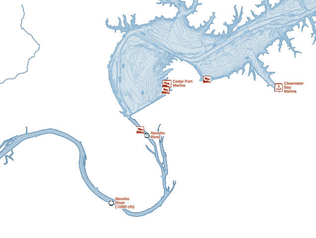
USGS Streamflows

Coverage Areas
United StatesObjective
Develop an efficient processing pipeline to create and maintain a tileset for displaying current streamflows published by the United States Geological Survey (USGS).Background
To meet the target objective, the workflow was split into three steps:• Collect stream gage metadata and geometry
• Pull the current streamflow observations
• Compare current observations to historic streamflowsStream gage geometries, station numbers, and current observations (gage height, discharge, water temperature) are pulled from the USGS's Instantaneous Values API. While the historic streamflows are aggregated from the USGS's Daily Values API.Current streamflow observations were rated as 'Above Normal', 'Normal', or 'Below Normal' based on the the last 40 years of daily average streamflows.To provided Gaia GPS users with recent streamflow observations, the tileset was optimized for cloud-based computing and automated to run every 6 hours.Styled by Lee France
Gaia GPS USFS Update
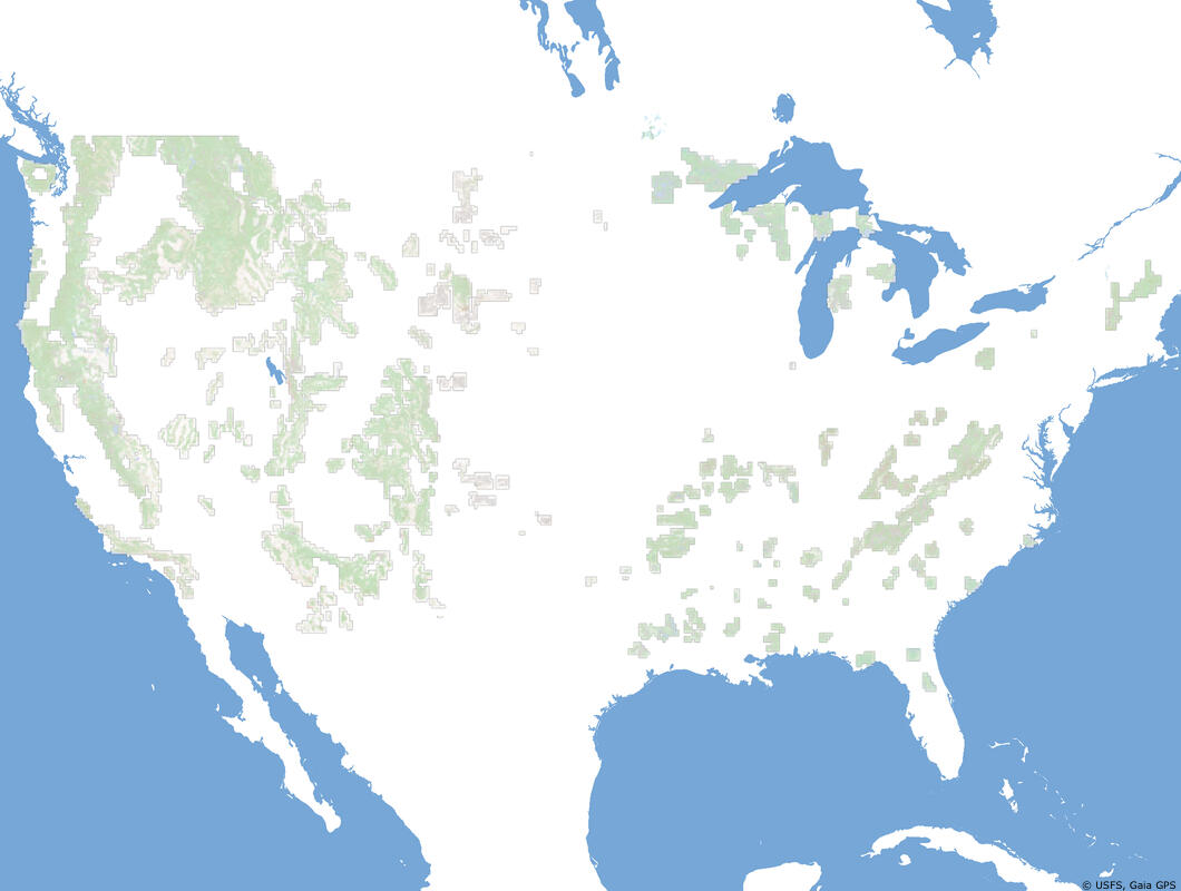
Coverage Areas
United States and Puerto RicoObjective
Develop an in-house tilesets for the three raster based United States Forest Service (USFS) map layers available within Gaia GPS.Background
This project is similar to the USGS Topo Update expect one the USFS map series required a licensing agreement for commercial use.Even though these map series were published by a single agency, each map series required slightly different workflows to produce the final tilesets. Some of the workflow variations included the following:• Extracting specific GeoPDF layers
• Modifying source data color tables
• Manually building a database of cutlinesResults
• USGS 2016 (updated)
• USFS Classic (updated)
• USFS Visitor (updated)
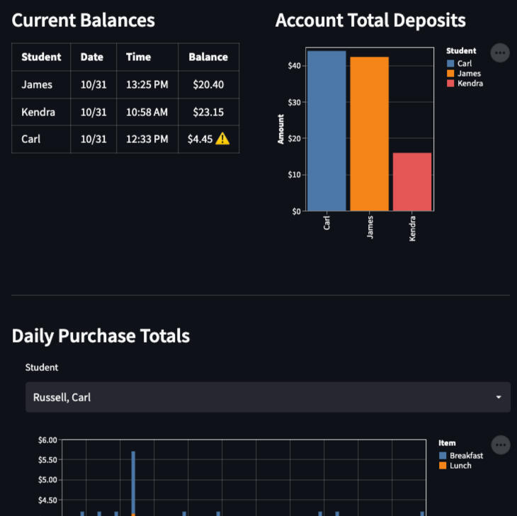
Lunch Money Dashboard
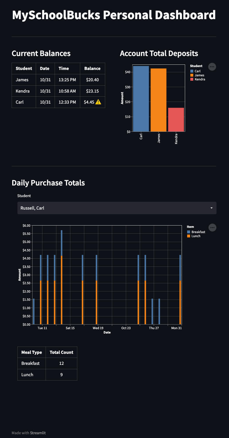
Objective
Create a simple dashboard to monitor linked account balances from a parent MySchoolBucks (MSB) accountBackground
From mid-2020 through May 2022, the United States Department of Agriculture (USDA) provided additional funding to via the National School Lunch Program (NSLP) to allow school districts to offer free meals to all enrolled students during the COVID pandemic.However, the additional funding for NSLP was not renewed for the 2022-2023 school year leaving school districts to roll back NSLP fund to pre-pandemic qualifications.Thus created the need to begin monitoring lunch account balances again and an opportunity to teach a little economics to my kids.Results
• Lunch Money (web app)
• Lunch Money (code base)The final product includes an interactive web app and a python script to collect MSB transaction history.The first section of the dashboard includes the most recent balance for the linked MSB account and plots the cumulative account deposits. The second section lets you select a linked MSB account and displays the daily transaction totals by meal type.